Submit Trail Condition

Trail Elevation
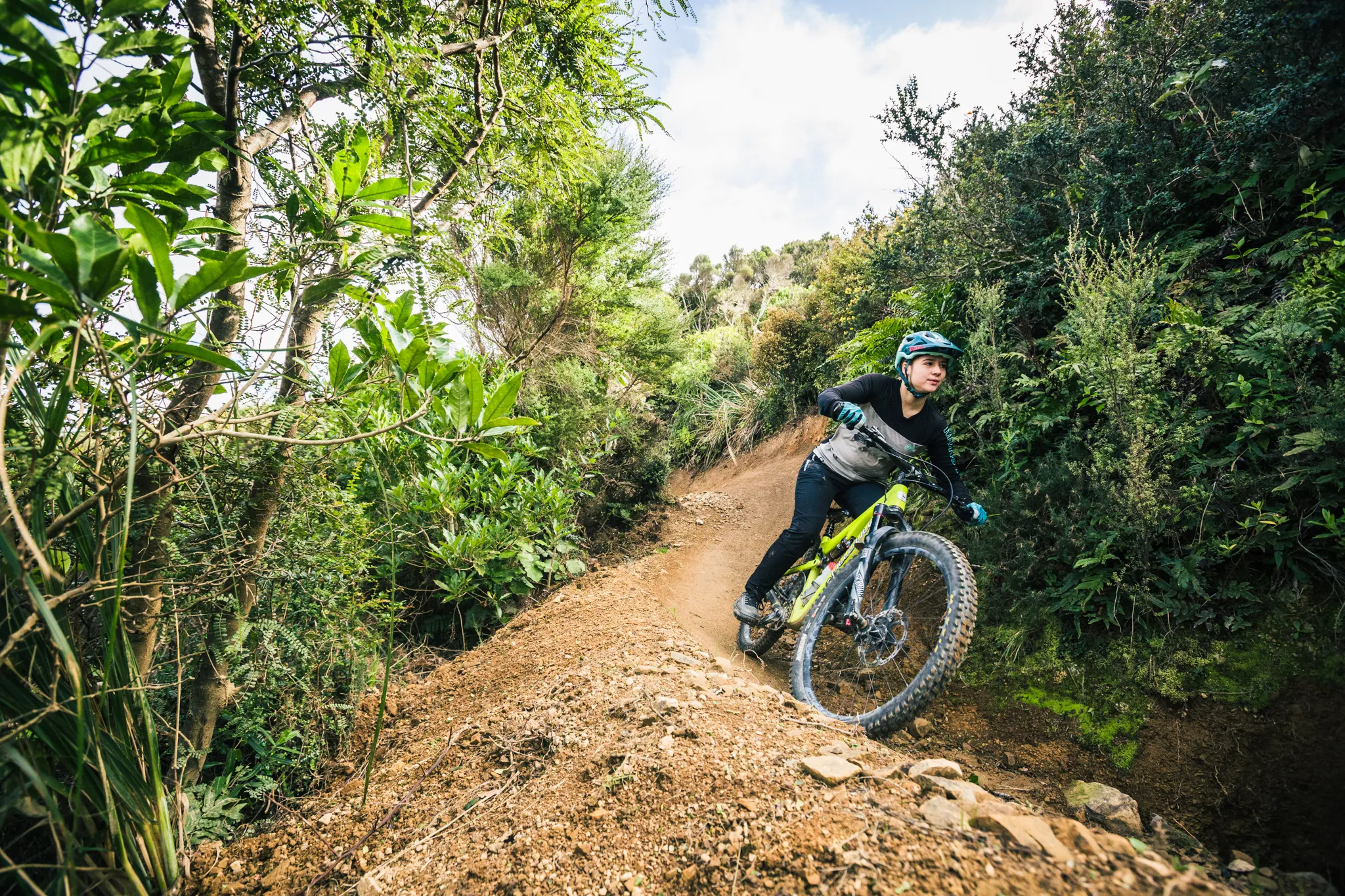
Trail Description
Videos
Current Trail Conditions
Borderline
BAMBA
Talk to us about building and maintaining trails in Belmont.

Belmont


Trail History
The Making of Borderline
A raw, rugged trail born from destruction and shaped by grit.
From Wasteland to Vision
After the 2012–2013 logging operations wiped out all trails in the Danzig pine block, BAMBA volunteers were left surveying a grim landscape – just tree stumps, debris, and slash. But where others saw devastation, BAMBA saw opportunity.
The team set their sights on the southern fence line, near the location of the old Last Sun trail, and plans began to take shape for a brand-new descent.
Breaking Ground
On 6 April 2014, the first official Borderline working bee took place, following a rough scoping mission. Enthusiasm was high – fortnightly digs consistently drew 10 to 20 local riders keen to rebuild after the Danzig clearfell.
Progress was swift. Within six weeks, BAMBA had carved out 415 metres of new trail with 45 metres of vertical descent – a huge effort by community standards.
By 3 June 2014, the trail was technically rideable top-to-bottom, albeit in a rough, unfinished state. But it was enough to get wheels turning and riders excited.
Naming the Trail: Borderline Calls
Initially dubbed “Quick Route”, a cheeky nod to its fast ride time (and a not-so-subtle innuendo), the name didn’t land well with Greater Wellington Regional Council (GWRC). The suggestion was quickly vetoed.
On 14 June, the trail was officially renamed Borderline – a title that proved to be far more fitting. It referred both to its geographic location along the Danzig southern border, and to its personality: a bit wild, a bit rough, and – at times – a bit sketchy.
Going Feral (on Purpose)
As the trail matured, it began to lean into its own identity. Unlike smoother, sculpted flow trails, Borderline remained intentionally raw, with rugged lines and uneven features left untouched.
This decision was a response to growing concerns from some in the MTB community that trails were becoming too sanitised. Riders loved that Borderline pushed back, offering a more natural and technical experience.
Volunteer Power and Key Milestones
While rideable, the trail still needed work before it could be called finished. In July 2014, a BNZ volunteer day brought out a large team that tackled major sections of the middle trail, including a new left-hand deviation around the steeper descent.
The new line was fun – briefly – but underused and quickly reclaimed by the bush.
Another BNZ day in early September, followed by multiple Sunday working bees, helped bring the rest of the trail up to standard. By the end of that month, a proper exit to the Woolshed car park was complete, and the trail was effectively done.
Final Touches and Seasonal Tweaks
With a dry summer ahead, progress slowed. Conditions weren’t suitable for building or retaining berms, and some of the trail’s corners began to blow out.
It wasn’t until April 2015, when moisture returned to the ground, that the team could revisit those spots and reinforce berms for better flow and sustainability.
Borderline by the Numbers
- Overall distance: 1,094 metres
- Highest point: 337 metres
- Vertical drop: 201 metres
- Time to build:
- Rideable: 2 months
- Completed: 12 months
- Rideable: 2 months
- Funny stat:
- Zero – the tolerance GWRC had for the name “Quick Route”
“Over time, Borderline grew into its name, unpredictable, unapologetic, and the kind of trail that reminds you what mountain biking used to feel like.”
Angus Cotton
🎉 Trails Love donations
Show your support, drop us a little coin. We need your help to ride on!
Build trails while you sleep, join now
Become an annual member for $30. Let's build a better community together.

trail etiquette
Riding or walking Wellington trails requires you to share the track, cycleway or road with others – fellow cyclists and walkers, but also dogs and horses. Here are a few important pointers to foster positive attitudes between different trail users and remember we are lucky that WCC have given us access to their land.

Share the Trail
Respect others on the track. Give way to walkers, use a bell or greeting, and be patient when passing. Ride in small groups and stay in control at all times.

Ride Only Where Allowed
Stick to open and permitted trails. Respect seasonal closures, leave gates as you found them, and plan ahead with food, tools, and warm clothing.

Protect the Track
Don’t damage the trail. Avoid skidding, cutting corners, or riding in wet conditions. Take your rubbish home and clean your bike to stop weeds spreading.

Follow Road Rules
Be predictable and courteous. Stop at lights, signal clearly, and let traffic pass when safe. Ride no more than two abreast and always offer a smile or wave.
pre ride, re-ride, freeride
Build confidence, not risk. Start slow with a warm-up lap to check the trail ("Pre-Ride"), go again to learn the features ("Re-Ride"), then let loose once you know what’s coming ("Free-Ride"). This approach helps you ride safer, progress faster, and have more fun.
1.
Pre-ride
2.
re-ride
3.
Free-ride
Upload content
We’d love to feature your photos or videos from this trail on the site. Just drop a YouTube, Dropbox, or cloud-sharing link into the URL field on the form. We’ll take care of the rest!
--/5 average rating from -- reviews
Tell us how it rides! Your trail review helps other mountain bikers find the best trails
Loading...